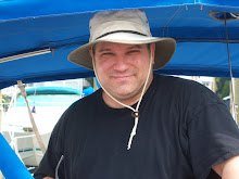
As mentioned in my last blog I had to move my boat from Fort Myers Beach to the slip I'm renting in Punta Gorda. There wasn't anyone handy to go with me on this trip so I did it by myself. A little challenging since I knew I'd have to dock a couple times (once at a fuel station and then again when I pulled into my slip). However, armed with some tunes, bottled water, my cell phone, and my charts, I didn't expect any serious issues.
Did I say charts? Oops. After the 5:00 AM rise and an hour long drive down to Fort Myers I discovered that I had forgot my charts. I had placed them the previous night at the foot of my bed so I wouldn't forget them. Guess that wasn't such a good place after all.
The problem now is that to get the charts I'd have to spend two more hours driving my car, but I didn't have two hours to spare. High tide in Fort Myers was at 7:45 AM and, according to the people at the boat yard, it was important to leave their yard around high tide. Also, I knew the trip would take approximately 9 hours and I absolutely did not want to navigate an unfamiliar harbor, by myself, at night. Sunset was at 5:48 PM (if memory serves) and it would be dark by 6:20. I needed to be out of the yard by 8:30 at the latest.
For those unfamiliar with boating and nautical charts, they look like a map but they are far more critical than road maps. A body of water as big as the Gulf Mexico is easy to draw on a regular map. However, to a sailboat with a draft of 4' 3" deep it is incredibly important to know how deep the water is at a given location. There are many places along the coast that look nice and deep over a mile from the shore that are really only 2' deep at low tide. Nautical charts show how deep or shallow given areas in great detail, as well as where certain navigational aids are located. Sailing without them in an unfamiliar area is fool hardy at best.
I decided to forego the charts and leave the boat yard ASAP.
I *had* studied the charts quite a bit the previous night so I had a pretty good idea of what markers I needed to hit to avoid shallow areas. Also, as I got underway, I called my cousin at the house and asked him to take the charts with him to work. As I needed course corrections I'd call him with my current GPS location and he could advise me which bearing I should follow.
This worked out pretty well. As I was skirting Sanibel Island I needed to find out how close I was to the shore. On the water you can see approximately 7 miles to the horizon, but its very difficult to judge how far away an object on the shore is. I knew I was closer than 7 miles, but I needed to be further than 2 miles or I'd come close to some very shallow water. I called Jimi up, gave him my coordinates, and he said I was 2.5 miles from the shore, and if I followed bearing 220 for another 4 miles I could start heading NW at about bearing 290.
I kept him appraised of my location every couple of hours and he pointed me in a new direction when needed. It worked rather well.
In the end, everything worked out just perfectly. I glided into my slip at around 6:15 PM or so... it wasn't quite dark as I was tying up the boat.
While everything turned out pretty well I'd have to say in hindsight that it was a pretty dumb move. I'd have been in deep trouble if I lost cell service while offshore. I was only about 4 miles off the coast at any given time, and I figured I'd be able to retain a signal, but it wasn't guaranteed. In fact, there was one point were I had no bars for about 45 minutes or so. Could I have made it anyway? Perhaps. There would have been a really tricky area between Boca Grande (the entrance to Charlotte Harbor) and the turn north to Punta Gorda that I could have conceivably ran into significant trouble.
Anyway, that all being said, it was a great trip. The Gulf of Mexico is absolutely beautiful and I can't wait to sail on it more.
Subscribe to:
Post Comments (Atom)


No comments:
Post a Comment